Monday, March 30, 2015

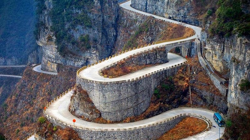
Heaven Linking Road, Tianmen Mountain | The Road of 99 Turns, China

Heaven Linking Road, Tianmen Mountain | The Road of 99 Turns, China

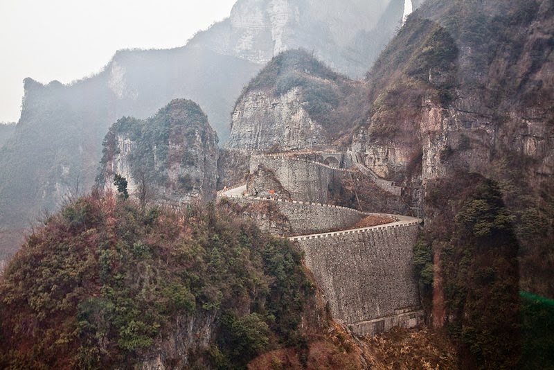
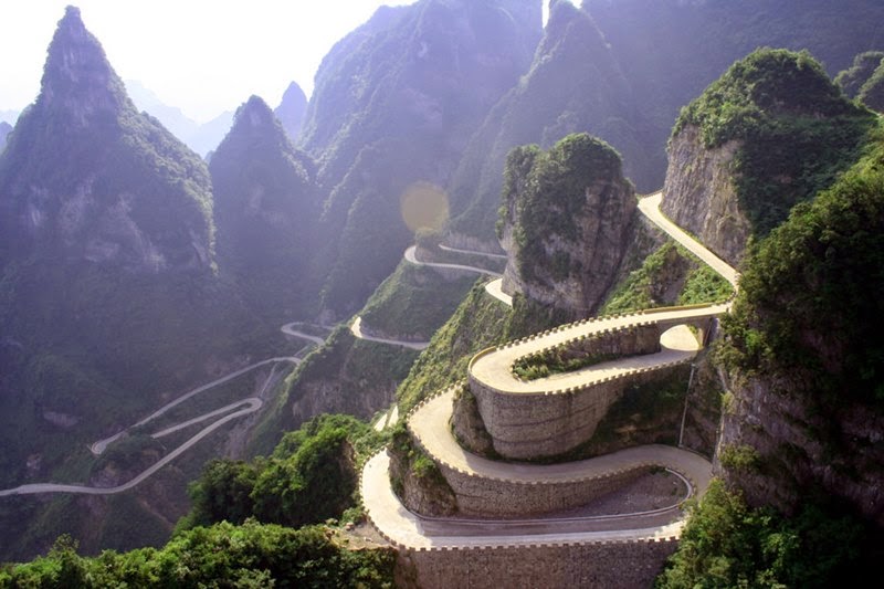
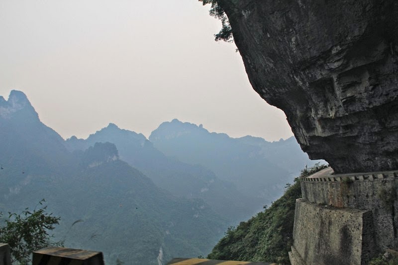
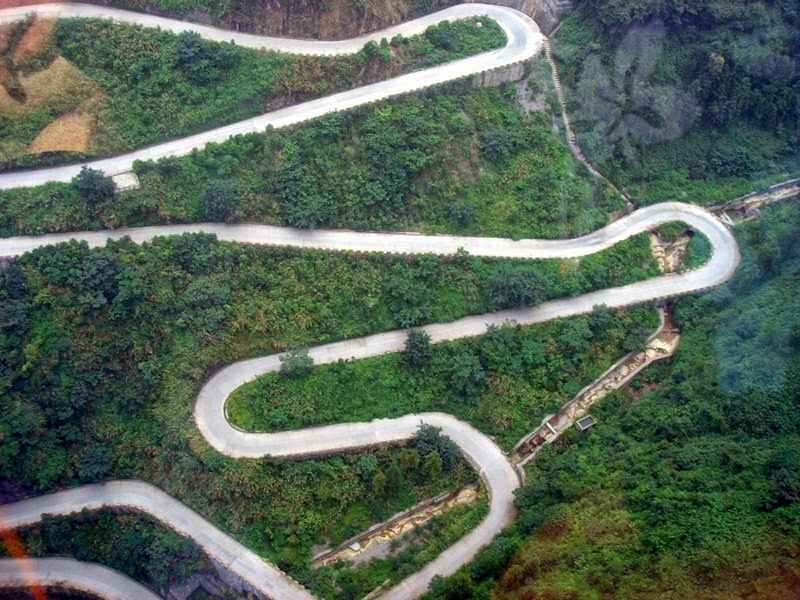
The Big Gate Road, Tianmen Mountain - The  Heaven Linking Road, China The Big Gate Road also known as heaven linking road, located in the National Park of  Tianmenshan, in the Hunan province of  China. The "Heaven linking road" rather this is most dangerous road in China. It starts south of Zhangjiajie city 200 meters above sea level and rises to 1,300 meters, with 99 blind turns, Sure, this increases the chances that you might end up in heaven in your car.  It is little wonder then that the road which was started in 1998 took eight years to complete. Its twists and turns are certainly not for the faint hearted. The road climbs Tianmen Mountain just south of Zhangjiajie City (which was previously called Dayong) is very much the must see scenic area in Hunan. 

Heaven Linking Road, Tianmen Mountain | The Road of 99 Turns, China

Image credit Nidhu Kashyap

It is also called the road of 99 turns – nine is a lucky number in China as it symbolizes that heaven has nine palaces. If the road is a little too scary for you, there is an alternative.  A cable car goes from of Zhangjiajie City to the top of Tianmen Mountain.  Sounds like out of the frying pan and in to the fire – the cable-way is 7455 meters in length making it, so the Chinese claim, the longest in the world.

Heaven Linking Road, Tianmen Mountain | The Road of 99 Turns, China
Image credit Sammy Tian Men Mountain

Heaven Linking Road, Tianmen Mountain | The Road of 99 Turns, China
Image credit zipp_car

Heaven Linking Road, Tianmen Mountain | The Road of 99 Turns, China
Image credit Mike Hatton

Heaven Linking Road, Tianmen Mountain | The Road of 99 Turns, China
Image credit YanShots

Heaven Linking Road, Tianmen Mountain | The Road of 99 Turns, China
Image credit Liu Tao

Heaven Linking Road, Tianmen Mountain | The Road of 99 Turns, China
Image credit Liu Tao

Heaven Linking Road, Tianmen Mountain | The Road of 99 Turns, China
Image credit Liu Tao

Heaven Linking Road, Tianmen Mountain | The Road of 99 Turns, China
Image credit B.B. Lill

Heaven Linking Road, Tianmen Mountain | The Road of 99 Turns, China
Image credit Sammy Tian Men Mountain

Source — Internet

Guelta d'Archei | Amazing lake in Sahara Desert

Guelta d'Archei | Amazing lake in Sahara Desert

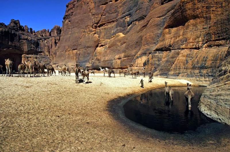
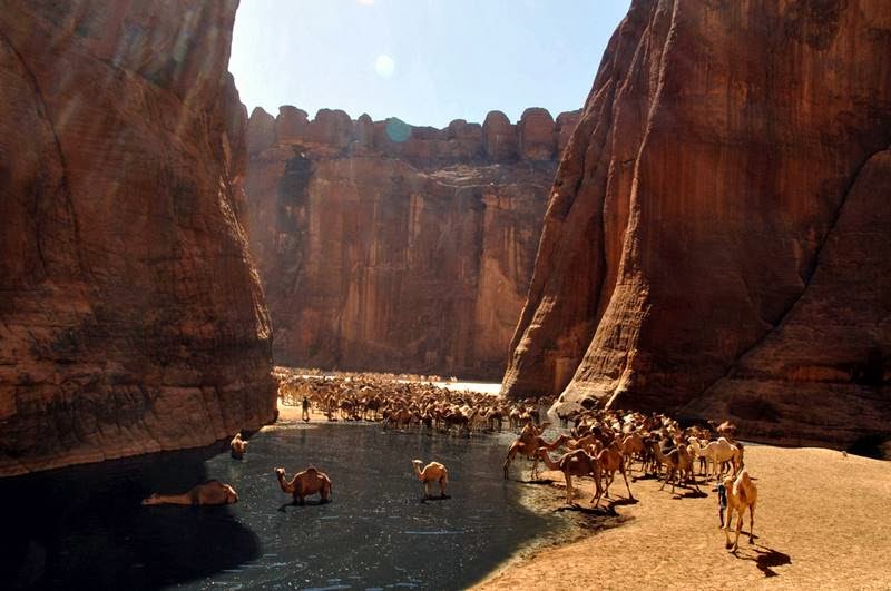
Guelta d'Archei amazing place in the heart of the Sahara Desert, It is located in the Ennedi Plateau, It is located in the Ennedi Plateau, in north-eastern Chad, south-east of the town of Fada. The Guelta d'Archei is inhabited by several kinds of animals, most notably the Nile crocodile, one of the last palace where Nile crocodiles are found in Sahara. The Middle Holocene remains, as well as rock paintings, indicate that this species once thrived across most of today's Sahara Desert and in swamps and rivers along South Mediterranean shores. The small group of surviving crocodiles in the Guelta d'Archei represent one of the last colonies know in the Sahara today; the Tagant Plateau colony in Mauritania has likely been extinct since 1996. The word Guelta means "wetland", The reservoirs of this wetland is supported by groundwater. Guelta d'Arshey is surrounded by extensive desert areas, which make access to this awesome place. 

Geltow d'Arshey located in the north-east of the Republic of Chad.
Image by Flickr user josephescu

The Guelta d’Archei is probably the most famous guelta in the Sahara
Image by Flickr user josephescu

The underground water meets a land depression and it comes to the surface, forming what we would call an oasis
Image by Flickr user A.Bielecki

The Guelta d'Archei is probably the most famous guelta in the Sahara. It is located in the Ennedi Plateau, in north-eastern Chad, south-east of the town of Fada. The Guelta d'Archei is inhabited by several kinds of animals, most notably the Nile crocodile
Image by Flickr user josephescu

The Guelta d'Archei is probably the most famous guelta in the Sahara. It is located in the Ennedi Plateau, in north-eastern Chad, south-east of the town of Fada. The Guelta d'Archei is inhabited by several kinds of animals, most notably the Nile crocodile
Image by Flickr user josephescu

The Guelta d'Archei is probably the most famous guelta in the Sahara. It is located in the Ennedi Plateau, in north-eastern Chad, south-east of the town of Fada. The Guelta d'Archei is inhabited by several kinds of animals, most notably the Nile crocodile
Image by Flickr user josephescu

Guelta d'Arshey | Amazing lake in Sahara Desert
Image by Flickr user josephescu

The Guelta d'Archei is probably the most famous guelta in the Sahara. It is located in the Ennedi Plateau, in north-eastern Chad, south-east of the town of Fada. The Guelta d'Archei is inhabited by several kinds of animals, most notably the Nile crocodile
Image by Flickr user josephescu

The Guelta d'Archei is probably the most famous guelta in the Sahara. It is located in the Ennedi Plateau, in north-eastern Chad, south-east of the town of Fada. The Guelta d'Archei is inhabited by several kinds of animals, most notably the Nile crocodile
Image by Flickr user josephescu

Guelta Archei is a watering place for camels located in the Ennedi plateau. The guelta is also inhabited by a very small number ( between 1 and 7 there are only estimations) of the Nile crocodile. This is one of the last colonies of crocodiles in the Sahara. There is another colony in Mauritania. You can see the crocodile on the right edge.
Guelta Archei is a watering place for camels located in the Ennedi plateau. The guelta is also inhabited by a very small number ( between 1 and 7 there are only estimations) of the Nile crocodile. This is one of the last colonies of crocodiles in the Sahara. There is another colony in Mauritania. You can see the crocodile on the right edge. Image by Flickr user Hannes Rada

The Guelta d'Archei is probably the most famous guelta in the Sahara. It is located in the Ennedi Plateau, in north-eastern Chad, south-east of the town of Fada. The Guelta d'Archei is inhabited by several kinds of animals, most notably the Nile crocodile
Image by Flickr user josephescu

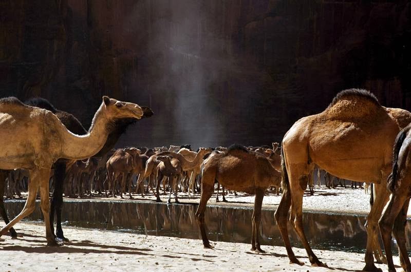
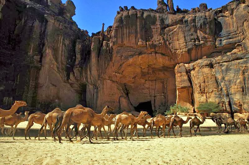
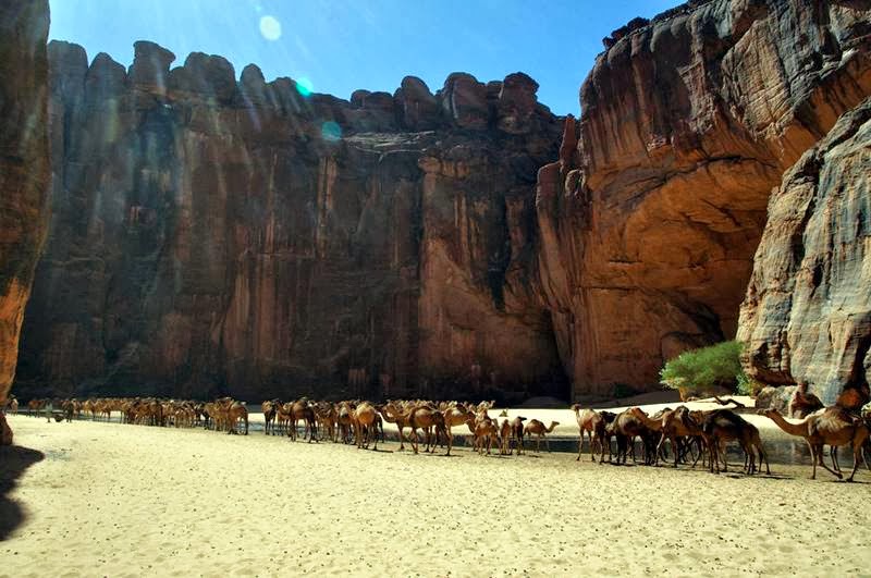
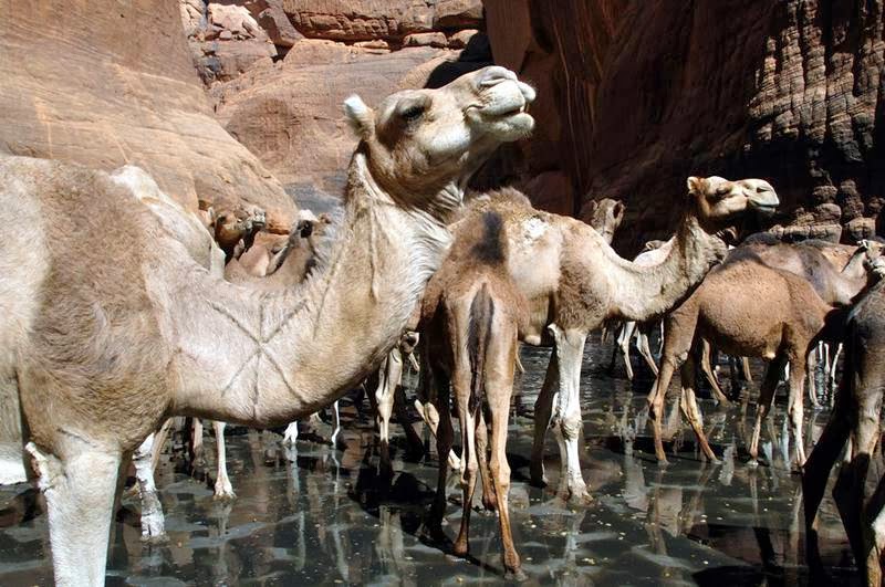
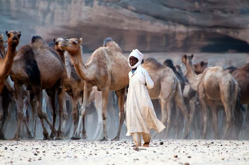
The Guelta d'Archei is the most famous permanent water source in the Ennedi region of Chad. Everyday, hundreds of camels are herded into the guelta in order to drink. That particular morning, one of the herdsmen was claiming that 850 of them were at once in the guelta. The value of a camel ranges between 250 EUR up to 800 EUR (and more). They are mainly raised for the milk they produce and as transport animals (not for the meat).
The Guelta d'Archei is the most famous permanent water source in the Ennedi region of Chad. Everyday, hundreds of camels are herded into the guelta in order to drink. That particular morning, one of the herdsmen was claiming that 850 of them were at once in the guelta. The value of a camel ranges between 250 EUR up to 800 EUR (and more). They are mainly raised for the milk they produce and as transport animals (not for the meat). Image by Flickr user A.Bielecki

Source — Wikipedia

The Salt Mine at Soledar, Ukraine

The Salt Mine at Soledar, Ukraine

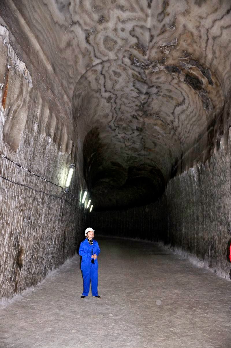
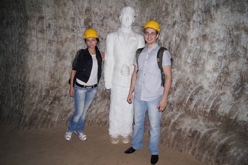
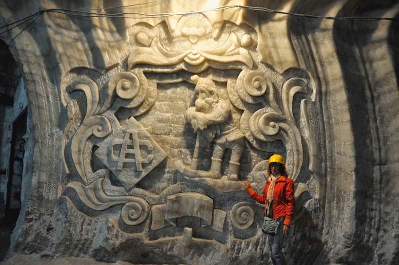
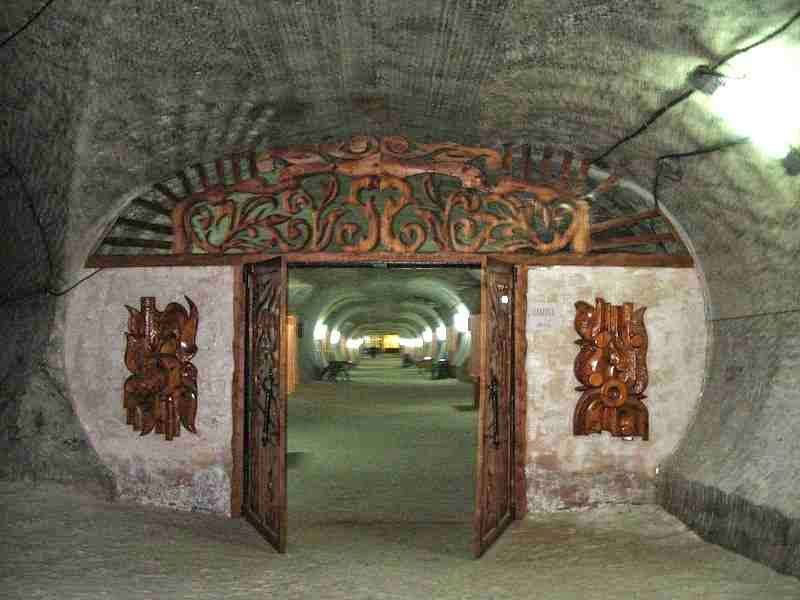
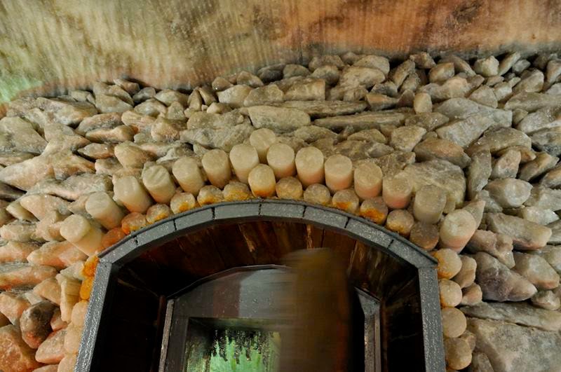
Soledar is a city in Donetsk Oblast of Ukraine. The name of the town stands for 'gift of salt' both in Russian and Ukrainian. The town was named Karlo-Libknekhtivsk after Karl Liebknecht, the German socialist, when it was created in 1965 during Soviet times. It was renamed Soledar in 1991 after the Ukraine became independent. This small is situated on the place of shallow bay of ancient Permian sea which existed there 250 millions years ago. After the sea dried out, here appeared one of the purest salt deposit in the world and the biggest one in Europe. In spite of more than 100 years of underground working, resulted in more than 125 miles of mines, these salt field resources are enough for 2 thousand years more.  While tourists are attracted not by functioning mines, but exhaust one which is added to the UNESCO list of world culture heritage. Miners who worked in it turned the empty mines into magnificent temples by creating sculptures, pictures, chapels and grottos from salt blocks. Everything here is made of salt: walls, ceiling, floor, figures and trees.
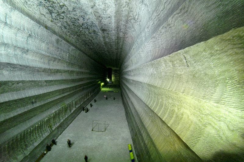
Soledar small is situated on the place of shallow bay of ancient Permian sea which existed there 250 millions years ago. After the sea dried out, here appeared one of the purest salt deposit in the world and the biggest one in Europe.
The route along the salty galleries of this underground city at a depth of 300 meters is about 700 meters long and ends with a huge hall of 40 meters height. The acoustics in the hall is so amazing that sometimes it becomes the concert hall for symphonic orchestra. Kurt Schmidt, Austrian composer and director says that there are only 2 or 3 theaters in the world that can compete the acoustics ofSoledar's salt mines: "I am impressed! The notes flew up to the arch of the grotto, and then slowly as a cloud fell down. Incredible!". [First Photo credit Lenelenka]

Soledar small is situated on the place of shallow bay of ancient Permian sea which existed there 250 millions years ago. After the sea dried out, here appeared one of the purest salt deposit in the world and the biggest one in Europe.
Photo credit Dmitry Panoff

Near the tourist route there is a speleo-sanitarium "Salty Symphony" where the following diseases are successfully cured: bronchial asthma, asthmatoid bronchitis, obstructive bronchitis, chronic pneumonia, rhinoallergosis, atopic dermatitis, some forms of psoriasis, weak immunity, thyroid diseases. Patients' sense of well-being is influenced by the following factors: atmospheric pressure 772 mm Hg (millimeters mercury column), air humidity 60%, temperature 14-16 °?, as well as air itself is filled with salt pieces with size of 1-5 micron and concentration of 15 mg in 1 cu m. The treatment in the microclimate of salt mine is one of the most effective because 70-85% adults and 85-95% children recover there according to statistics. 

Soledar small is situated on the place of shallow bay of ancient Permian sea which existed there 250 millions years ago. After the sea dried out, here appeared one of the purest salt deposit in the world and the biggest one in Europe.
Salt Mine Music Hall, Soledar, Ukraine 
Imagine a salt pebble as large as a city and your right in the middle of it. Photo credit Andrei Stolper

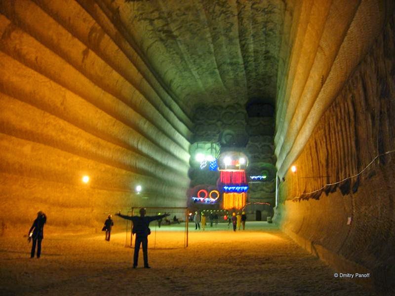
Usually the tour goes on for about 4 hours. During this time tourists can visit underground football field, church, labyrinths, concert hall, gallery, see the original figures made of salt, take a rest at underground bar, watch a movie about speleo-sanitarium, take pictures and video, play billiards, table tennis, chess, and simply have a rest and breathe the unique air of salt mine. Along the route medical staff and guide will do some training in medical respiratory gymnastics and tell interesting stories about the salt mine.

Soledar is a town which name stands for "gift of salt". We visited its major sight: the underground galleries and chambers of salt mines
Soledar is a town which name stands for "gift of salt". We visited its major sight: the underground galleries and chambers of salt mines. Photo credit Zfort Group

Soledar small is situated on the place of shallow bay of ancient Permian sea which existed there 250 millions years ago. After the sea dried out, here appeared one of the purest salt deposit in the world and the biggest one in Europe.
Photo credit Zfort Group

The people there is a perception that the salt is harmful to the body in large quantities. This applies to its consumption as food. But a visit to the seabed, when there is not a single object of a different material than salt, very useful, especially for the imagination. A breath of air saturated micro-particles of salt - all powerful healing effect.

Soledar small is situated on the place of shallow bay of ancient Permian sea which existed there 250 millions years ago. After the sea dried out, here appeared one of the purest salt deposit in the world and the biggest one in Europe.
Photo credit Thierry Sturm

Sculptures created not Mother Nature, and the master with golden hands. Sinking to a depth of nearly 300 meters, you get the opportunity to walk along the bottom of the oceans, see the real football field with shallow salt crumbs instead of green grass , with a stunning concert hall acoustics.

Soledar small is situated on the place of shallow bay of ancient Permian sea which existed there 250 millions years ago. After the sea dried out, here appeared one of the purest salt deposit in the world and the biggest one in Europe.
Photo credit Thierry Sturm

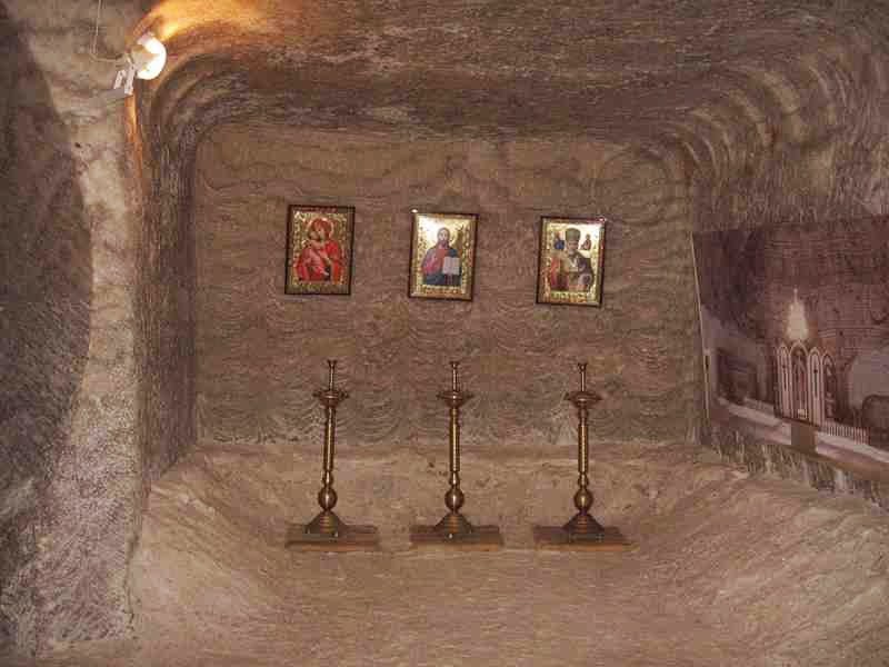
There is a church in one of the worked out salt galleries of the city. In December 2003, the chamber 41 bis broke a record listed in the Guinness Book of Records as the first underground "Hopper" ballooning. In October 2004 there was a concert of Donbass Symphony Orchestra "Salt Symphony" under the direction of Austrian conductor Kurt Schmid with a participation of Victoria Lukyanets, soloist of the Vienna State Opera.
There is a church in one of the worked out salt galleries of the city. In December 2003, the chamber 41 bis broke a record listed in the Guinness Book of Records as the first underground "Hopper" ballooning. In October 2004 there was a concert of Donbass Symphony Orchestra "Salt Symphony" under the direction of Austrian conductor Kurt Schmid with a participation of Victoria Lukyanets, soloist of the Vienna State Opera. Photo credit Thierry Sturm

Soledar is a town which name stands for "gift of salt". We visited its major sight: the underground galleries and chambers of salt mines.
Soledar is a town which name stands for "gift of salt". We visited its major sight: the underground galleries and chambers of salt mines. Photo credit Zfort Group

soledar ukraine
Photo credit Thierry Sturm

Soledar small is situated on the place of shallow bay of ancient Permian sea which existed there 250 millions years ago. After the sea dried out, here appeared one of the purest salt deposit in the world and the biggest one in Europe.
Soledar Ukraine —  is a town which name stands for "gift of salt". We visited its major sight: the underground galleries and chambers of salt mines. Photo credit Zfort Group

Source — Wikipedia | Showcaves | Discover-Ukraine | Topertravel | Krt.dp
The Most Dangerous Road In The World | Death Road, La Paz, Bolivia

The Most Dangerous Road In The World | Death Road, La Paz, Bolivia

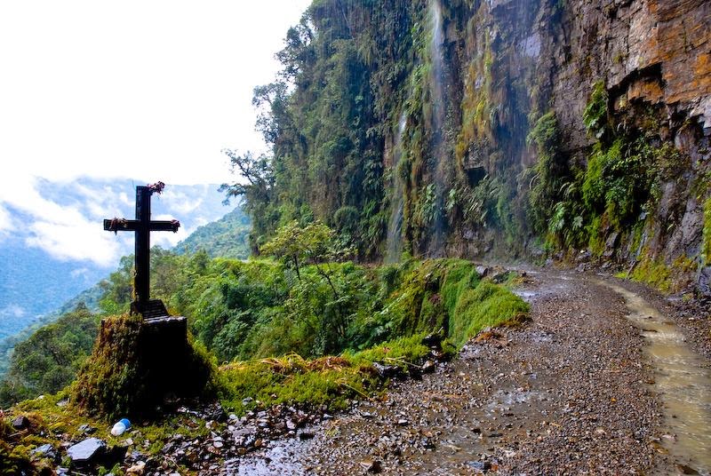
Death Road in the Yungas region of Bolivia, also called Grove's Road, Coroico Road, Camino de las Yungas and Road of fate. Leading from La Paz to Coroico, 56 kilometres northeast of La Paz in the Yungas region of Bolivia. It is legendary for its extreme danger and in 1995 the Inter-American Development Bank christened it as the "world's most dangerous road", Same as from south — A South Yungas Road (Chulumani Road) exists that connects La Paz to Chulumani, 64 kilometres east of La Paz, and is considered to be nearly as dangerous as the North Road. 

Road death was built in the 1930s during the Chaco War between Bolivia and Paraguay Paraguayan prisoners. One of the few routes connecting the Amazon rainforest in northern Bolivia, in particular, the city of Coroico, in La Paz, the largest city in the country.

Death Road in the Yungas region of Bolivia, also called Grove's Road, Coroico Road, Camino de las Yungas and Road of fate. Leading from La Paz to Coroico, 56 kilometres northeast of La Paz in the Yungas region of Bolivia.
Image credit The World by Road

This is one of the few routes that connects the Amazon rain-forest region of northern Bolivia, or Yungas, to its capital city. Upon leaving La Paz, the road first ascends to around 4,650 meters  or 15,260 ft at La Cumbre Pass, before descending to 1,200 meters  or 3,900 ft at the town of Coroico, transiting quickly from cool Altiplano terrain to rain-forest as it winds through very steep hillsides and atop cliffs.
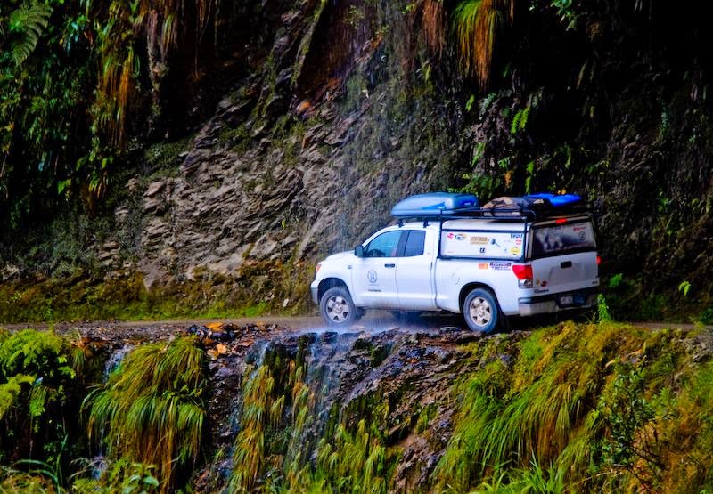
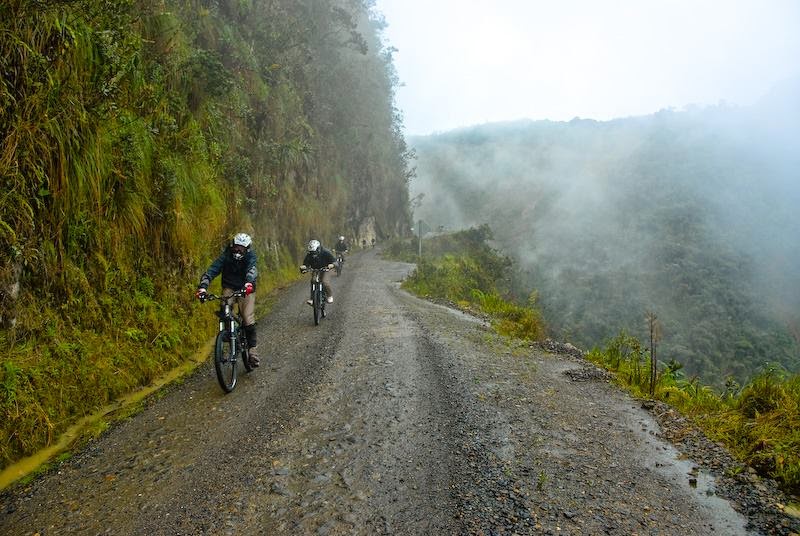
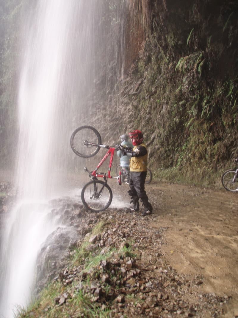
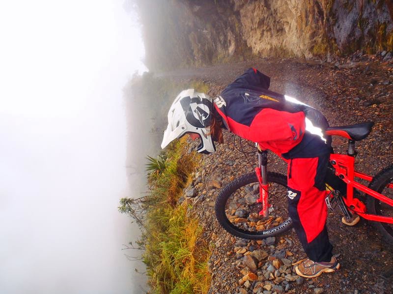
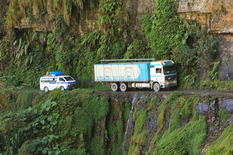
The largely single-lane road has no guard rails and cliffs of up to 600 meters (2,000 feet). Most of the road is the width of a single vehicle, about 3.2 meters (10 ft). During the rainy season from November through March, rain and fog can severely hamper visibility, and water runoff can turn the road into a muddy track, affecting traction. In the summer, rockfalls are common and vehicle dust limits visibility as well.

One of the local road rules specifies that the downhill driver never has the right of way and must move to the outer edge of the road. This forces the faster downhill vehicle to stop so that passing can be negotiated safely. Unlike the rest of Bolivia, vehicles are required to drive on the left side of the road, to give the driver a better view of the vehicle's outside wheel and making passing safer. [Source —Wikipedia]
Death Road in the Yungas region of Bolivia, also called Grove's Road, Coroico Road, Camino de las Yungas and Road of fate. Leading from La Paz to Coroico, 56 kilometres northeast of La Paz in the Yungas region of Bolivia.
Image credit The World by Road

The danger of the road made it a popular tourist destination starting in the 1990s, drawing some 25,000 thrillseekers. Mountain biking enthusiasts in particular have made it a favourite destination for downhill biking since there is a 64-kilometre (40 mi) stretch of continuous downhill riding with only one short uphill section. There are now many tour operators catering to this activity, providing information, guides, transport, and equipment. Nevertheless, the Yungas Road remains dangerous. At least 18 cyclists have died on the ride since 1998. [Source —Wikipedia]

Death Road in the Yungas region of Bolivia, also called Grove's Road, Coroico Road, Camino de las Yungas and Road of fate. Leading from La Paz to Coroico, 56 kilometres northeast of La Paz in the Yungas region of Bolivia.
Image credit The World by Road

Death Road in the Yungas region of Bolivia, also called Grove's Road, Coroico Road, Camino de las Yungas and Road of fate. Leading from La Paz to Coroico, 56 kilometres northeast of La Paz in the Yungas region of Bolivia.
Image credit The World by Road

Death Road in the Yungas region of Bolivia, also called Grove's Road, Coroico Road, Camino de las Yungas and Road of fate. Leading from La Paz to Coroico, 56 kilometres northeast of La Paz in the Yungas region of Bolivia.
Image credit The World by Road

Death Road in the Yungas region of Bolivia, also called Grove's Road, Coroico Road, Camino de las Yungas and Road of fate. Leading from La Paz to Coroico, 56 kilometres northeast of La Paz in the Yungas region of Bolivia.
Image credit The World by Road

Death Road in the Yungas region of Bolivia, also called Grove's Road, Coroico Road, Camino de las Yungas and Road of fate. Leading from La Paz to Coroico, 56 kilometres northeast of La Paz in the Yungas region of Bolivia.
Image credit Thrudur Helgadottir

Death Road in the Yungas region of Bolivia, also called Grove's Road, Coroico Road, Camino de las Yungas and Road of fate. Leading from La Paz to Coroico, 56 kilometres northeast of La Paz in the Yungas region of Bolivia.
Image credit fatbackpack

Death Road in the Yungas region of Bolivia, also called Grove's Road, Coroico Road, Camino de las Yungas and Road of fate. Leading from La Paz to Coroico, 56 kilometres northeast of La Paz in the Yungas region of Bolivia.
Image credit truces66

Death Road in the Yungas region of Bolivia, also called Grove's Road, Coroico Road, Camino de las Yungas and Road of fate. Leading from La Paz to Coroico, 56 kilometres northeast of La Paz in the Yungas region of Bolivia.
Image credit ngaire hart (lawson)

Death Road in the Yungas region of Bolivia, also called Grove's Road, Coroico Road, Camino de las Yungas and Road of fate. Leading from La Paz to Coroico, 56 kilometres northeast of La Paz in the Yungas region of Bolivia.
Image credit Craig Bridges

Source: Internet

Thursday, March 26, 2015

Bhangarh Fort: The 'most haunted' place in India?

Bhangarh (Hindi: भानगढ़) is a village in India that is famous for its historical ruins. It is in the Rajgarh municipality of the Alwar district in the state of Rajasthan.[1] Bhangarh is at the edge of the Sariska Tiger Reserve.

Country India
StateRajasthan
DistrictAlwar
Elevation380 m (1,250 ft)
Population (2001)
 • Total1,306
Languages
 • OfficialHindi
Time zoneIST (UTC+5:30)
Vehicle registrationN/A
Nearest cityDausa
Sex ratio677 / 629[1] /
Lok Sabha constituencyJaipur
Vidhan SabhaconstituencyAlwar Gramin
ClimateTropical (Köppen)

Description

Bhangarh is a place between Jaipur and Delhi in Rajasthan state of India known for its ruins. Bhangarh is also a pre-historic site. The most remarkable of its buildings are the Hindu temples of GopinathaShiva (Someshwar), HanumanaGanesha, Vishal Devta, Lavina Devi and Keshava Rai. Other buildings include shops along the main road, several havelis, a mosque, and a palace.The palace was protected by two inner fortifications across the valley. The town is separated from the plain by ramparts with five gates.
The town was established in 1573 (VS 1631) during the rule of Bhagwant Das as the residence of his second son Sawai Madho Singh, the younger brother of Emperor Akbar’s general, Man Singh I. Madho Singh participated in many campaigns with his father and brother. The next ruler of Bhangarh was his son Chhatra Singh[3] after whose death in 1630, Bhangarh slowly declined. When the Mughal Empire became weaker after the death of AurangzebJai Singh II attached Bhangarh to his state by force in 1720. After this Bhangarh diminished in population, and since the famine of 1783 (VS 1840) the town has remained uninhabited.
Entry to Bhangarh is legally prohibited between sunset and sunrise. A signboard posted by ASI (Archaeological Survey of India), which is a Government of India organization, specifies the instructions. While the board is written in Hindi, the instructions on it roughly translate into: "Entering the borders of Bhangarh before sunrise and after sunset is strictly prohibited. Legal action would be taken against anybody who does not follow these instructions". Some other rules are there according to which no one is allowed to graze their animals after sunset.

Geography

The Bhangarh Fort is located on the border of the Sariska Reserve in the Aravali range of hills in Alwar district of Rajasthan.The nearest village is Golakha.The fort is situated at the foot of the hills on sloping terrain. The ruins of the King’s palace is located on the lower slopes of the hills and trees surround the pond area and a natural stream falls into the pond within the premises of the palace.
The fort is located 235 kilometres (146 mi) from Delhi and the approach to the entrance gate of the fort in the last 2 kilometres (1.2 mi) stretch of the road is an unpaved road.[4] The fort is 20 miles (32 km) from Thana Ghazi.

Legends

There are two legends narrated to the history of the fort city which is reported to be haunted and no one is allowed to remain the precincts of the fort at night as per a notice board put up by the Archaeological Survey of India at the entrance.
One version of the legend is that a sadhu named Baba Balanath lived within the fort area. It was his injunction that any houses built in the precincts of the fort should not be taller than his house and in case the shadow of any such house falling on his house would result in destruction of the fort town.
In another version, Singhiya, the wizard who was adept in black magic fell in love with Ratnavati, the princess of Bhangarh who was very beautiful and had suitors to marry her from many royal families of the country. One day while the princess, 18 years of age, went shopping with her friends and was buying Ittar (scent). The wizard saw this and replaced the scent with some potion in order to ensnare the princess. He offered the potion to her so that she took a liking for him and marry him.However, the princess saw through the wizard's trickery and when he offered her the bowl of potion, she threw it on a big boulder nearby and as a result the boulder started rolling down towards the wizard and crushed him. Before he died he cursed that Bhangarh would be destroyed soon and no one will be able to live within its precincts. Subsequent to the curse Bhangarh Fort was invaded by the Mughals from the north and the city was surrounded and sacked; 10,000 people lived in the fort city at that time. All the people in the fort including the princess were killed. The present state of the fort is attributed to the curse of the wizard and people believe the ghosts in the fort are that of the princess and the wizard.Since that day, it is believed that paranormal activities take place here during the nights. Some deaths have been reported due to these paranormal activities too.

Features

Entering through the main gate of the completely ruined fort city - now called the "Bhoot Bangla" or the "House of Ghosts" - gives an eerie feeling. Within the fort, at the main entry, one can find temples, palaces and havelis. In addition, there are four more gates of entry to the fort – the Lahori Gate, the Ajmeri Gate, the Phulbari Gate and the Delhi Gate. At the entrance of the main gate, are many Hindu temples such as Hanuman TempleGopinath TempleSomeshwar TempleKeshav Rai TempleMangla Devi TempleGanesh Temple and Navin Temple.The Gopinath Temple is built above a 14 ft raised plinth and yellow stones are used for the exquisite carvings of the temple.The residence of the priest called the Purohitji Ki Haveliis located in the precincts of the temple complex. Next in order is the Nachan Ki Haveli (dancer's palace) and Jauhari Bazar(market place) followed by the Gopinath Temple. The Royal Palace is located at the extreme end of the fort’s limits.
The temples dedicated to Hanumana and Mahadeva are very elegant but need to be preserved. However, they are built in the style of cenotaphs rather than temples. Jhirri marble has been used in their construction but presently covered by white wash. The Muslim tomb found outside the gate of the fort is reported to be that of one of the sons of King Hari Singh who converted to Islam.
Bhangarh Fort 
Bhangarh Fort

Interior view of Bhangarh Fort
Source: Internet